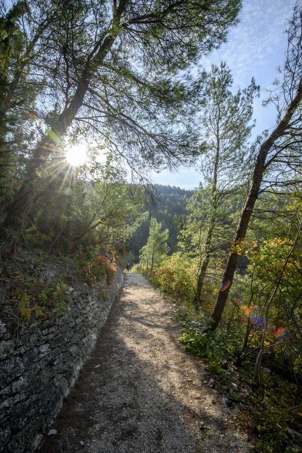
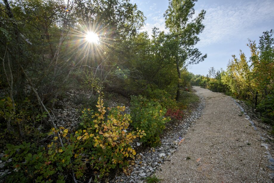
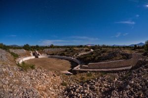
Hike trail
Goriš

LENGTH

2950 m

VIEWPOINTS

Torak

START/END: GORIŠ

On the road Šibenik – Drniš, follow the signs for the settlement Goriš and the educational walking trail, in Goriš follow the signposts

Lokacije:

Apparent:
Vlažnost: %
Vjetar:
UV indeks:
Izlazak sunca:
Zalazak sunca:
 

Goriš trail

  • On the road Šibenik – Drniš, follow the signs for the settlement Goriš and the educational walking trail, in Goriš follow the signposts
  • There are three ways to reach this trail
  • Parking in the open along the road passing through the settlement
  • Educational walking trail Goriš – Torak viewpoint, 1 500 m, is a gravel and earthen trail that leads right up to the viewpoint Walking trail Goriš – Torak, 1 450 m, is a gravel trail that descends down to Torak Lake
Karst spring in the confluence

The confluence of the Krka and Čikola Rivers is an unusual and mystical sight. Here nature has formed an island to divide the two rivers and the lake that is not a lake. With the raising of the travertine barriers at Skradinski buk waterfall, 13 km of the course of the Krka River were transformed into a lake-like expansion, and 3 km of the Čikola River were submerged, creating the most unusual confluence landscape in Croatia. The islet Kalički Busen, about 700 m in length and just 10 m wide, stands here, and is actually a travertine barrier that separates the Krka River from the mouth of the Čikola River.

In this tranquil landscape, all appears to be calm, with its tall reeds and sedges, with only the birds flying overhead reminding us of the passing time. In the centre of the landscape, like the pupil of an eye, is Torak, a lake-like spring. Though this is a spring, due to its round shape it looks more like a lake, and so we call it the lake spring. It is 150 m in diameter, about 30 m deep, and the spring itself is at the bottom of the lake. This karst spring gives pure, clean, drinking water, which was once used to irrigate most of the villages in the southeastern part of Šibenik-Knin County. Today it feeds the soul, leaving us to think deeply about the harmony of nature.

The trail itself forks here, one part leading to the viewpoint, and other descending down towards Torak, with a view over the two intertwining rivers as though from the bird's perspective. In walking along the trail that was once used by the local population to reach their fields and gardens, today you can spend an active morning or afternoon, enjoying the peaceful and personal experience of the national park, observing the confluence on one side, and seeking out a view of the Ključica fortress on the other, which leads towards the Čikola Canyon. Long ago, there was a fortress at Goriš that was erected by the people of Šibenik in 1342 as a defensive structure to protect against the Turkish conquests. It was ultimately destroyed by the Ottoman forces. However, it is good to know that even small places have their spot in history, their paths and hidden gems of nature. Or in this case – sapphires.           

Goriš – Torak – vidikovac Torak, 2 950 m     

EU PROJECT UNKNOWN KRKA

Reconstruction of three hike paths within the EU project

Roman road trail

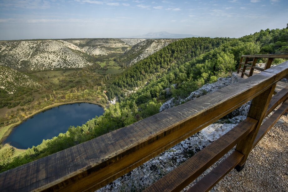
Pješačka staza Rimski put DUŽINA 630 m VIDIKOVCI: START/END: Ivoševac Na parkiralište se dolazi iz Ivoševaca, iz smjera Kistanje – Knin Staza Rimski put Na

Perice trail

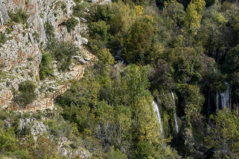
Pješačka staza Perice DUŽINA 1800 m VIDIKOVCI: START/END: Nečven Staza Perice Dolazak od Nečvena, na lijevoj obali, u smjeru Oklaj – Kistanje Automobile je moguće

Manojlovac trail

Pješačka staza Manojlovac DUŽINA 360 m VIDIKOVCI: START/END: Ivoševac Na parkiralište se dolazi iz Ivoševaca, iz smjera Kistanje – Knin Staza Manojlovac Na parkiralište se

SEE BIKE ROUTES

Krka Bike – Trek1

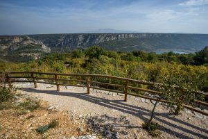
Krka Bike Trek 1 DUŽINA 11,4 km USPON 273 m TEŽINA 1/4 VIDIKOVCI: BURNUM START/END: PULJANE (centar za posjetitelje) N 44° 00’ 06.3” E 16°

Krka Bike – Road1

Krka Bike Road 1 DUŽINA 58,8 km USPON 1156 m VIDIKOVCI: KANJON ČIKOLE, ROŠKI SLAP, LAŠKOVICA START/END: SKRADIN (centar za posjetitelje) N 43° 49′ 01,5’’

Krka Bike – MTB1

Krka Bike MTB1 DUŽINA 25,8 km USPON 680 m TEŽINA 2/4 VIDIKOVCI: Žurića brdo, Brdo sv. Kate, Vukovića podi START/END: SKRADIN (centar za posjetitelje) N