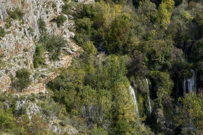
Roman road trail
Pješačka staza Rimski put DUŽINA 630 m VIDIKOVCI: START/END: Ivoševac Na parkiralište se dolazi iz Ivoševaca, iz smjera Kistanje – Knin Staza Rimski put Na
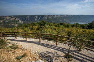
The path begins at the place whether there has been a crossing across the river since ancient times. This crossing connected the Bukovica and Promina regions in the period of the famous Burnum military camp, and was part of the network of Roman roads in Dalmatia. The path begins on the left bank directly above the Brljan waterfall and connects it with Manojlovac, the highest waterfall on the Krka River.Promonu) bio je dijelom mreže rimskih putova u Dalmaciji. Staza na lijevoj obali rijeke, neposredno iznad Brljana, povezuje taj slap s Manojlovcem, najvišim slapom na Krki.
On the right bank, the Bukovica side, lie the remains of the Roman military camp of Burnum, and on the left, the Promina side, the remains of the prehistoric hillfort of Puljane, center of Liburnian tribe Burnistae. The hillfort covers an area of about 5000 m². It is located on a plateau above the steep, high cliffs that protect the Krka River on both banks. Towards the south, the hillfort is enclosed by a rampart 160 long, about 30 m wide at the foundation level, and about 6m high. The remains of some 50 dwelling foundations can still be seen on it today. It was mentioned by the ancient writer Pliny as Castellum Burnum. It was undoubtedly an important center in the border area of the Delmatae and Liburni, as a point from which the crossing over the river was monitored. The large quantity of pre-Roman and Roman pottery at the hillfort bears witness that it continued to exist after the Roman conquest and the establishment of the military camp (castrum) of Burnum on the opposite bank of the river. To walk along this trail and see the site of the hillfort will return you to the distant past when the Romans defeated the resisting Dalmatae, an Illyrian tribe after which the present region of Dalmatia is named. Castellum Burnum spominje je antički pisac Plinije. Nedvojbeno je bila važno središte u graničnom području Delmata i Liburna s kojeg je nadziran prijelaz preko rijeke. Velika količina predrimske i rimske keramike u gradini svjedoči da je nastavila živjeti i nakon rimskih osvajanja i osnutka vojnog logora (kastruma) Burnum na suprotnoj obali rijeke. Šetnja ovom stazom i pogled na Gradinu vratit će vas daleko u prošlost kada su ovuda hodili i Rimljanima prkosili borbeni Delmati, ilirsko pleme po kojemu se zove današnja Dalmacija.
Brljan waterfall is followed by a lake, created by a dam, which extends 1.3 km upstream. The Brljan Lake (Ćorića jezero, Bjelober) is 400 m wide and 1300 m long. The landscape changes here. The legends of the Krka River whisper that a winged dragon took the beautiful Miljeva and her beloved fiancé Bogdan to the bottom of Brljan Lake. But do not let old tales frighten you, because this trail is gentle and soothing with the comforting presence of nearby water. The ragged karst landscape at Brljan Lake turns into a softer, fertile land, and the Krka River enters a plain. The water of the lake pours over the Brljan waterfall only during times of high waters. The length of the travertine barriers of the Brljan waterfall is about 300 m, with a width of about 180 m, and a total descent of 15.5 m. The waterfall is surrounded by lush sub-Mediterranean vegetation, small pastures, and cultivated fields. During the warmer part of the year, the waterfall is dry, and the almost half a kilometer lake-like course of the Krka River between the Brljan and Manojlovac waterfalls also dries out. That is why the sub-Mediterranean vegetation is particularly lush in the spring. Grain was ground in the numerous watermills at Brljan, which are now abandoned (and also on the other bank), slowly being taken over by the dense vegetation, hiding them from human sight.

Pješačka staza Rimski put DUŽINA 630 m VIDIKOVCI: START/END: Ivoševac Na parkiralište se dolazi iz Ivoševaca, iz smjera Kistanje – Knin Staza Rimski put Na
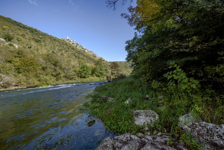
Pješačka staza Perice DUŽINA 1800 m VIDIKOVCI: START/END: Nečven Staza Perice Dolazak od Nečvena, na lijevoj obali, u smjeru Oklaj – Kistanje Automobile je moguće
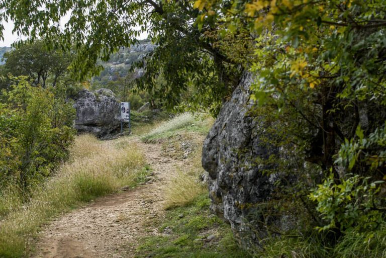
Pješačka staza Manojlovac DUŽINA 360 m VIDIKOVCI: START/END: Ivoševac Na parkiralište se dolazi iz Ivoševaca, iz smjera Kistanje – Knin Staza Manojlovac Na parkiralište se
Krka Bike Trek 1 DUŽINA 11,4 km USPON 273 m TEŽINA 1/4 VIDIKOVCI: BURNUM START/END: PULJANE (centar za posjetitelje) N 44° 00’ 06.3” E 16°
Krka Bike Road 1 DUŽINA 58,8 km USPON 1156 m VIDIKOVCI: KANJON ČIKOLE, ROŠKI SLAP, LAŠKOVICA START/END: SKRADIN (centar za posjetitelje) N 43° 49′ 01,5’’

Krka Bike MTB1 DUŽINA 25,8 km USPON 680 m TEŽINA 2/4 VIDIKOVCI: Žurića brdo, Brdo sv. Kate, Vukovića podi START/END: SKRADIN (centar za posjetitelje) N
Plan your vacation and explore the unknown treasures of the Krka River.
Person in charge of communication: Ivona Cvitan
E-mail: ivona.cvitan@npk.hr
| Cookie | Duration | Description |
|---|---|---|
| cookielawinfo-checbox-analytics | 11 months | This cookie is set by GDPR Cookie Consent plugin. The cookie is used to store the user consent for the cookies in the category "Analytics". |
| cookielawinfo-checbox-functional | 11 months | The cookie is set by GDPR cookie consent to record the user consent for the cookies in the category "Functional". |
| cookielawinfo-checbox-others | 11 months | This cookie is set by GDPR Cookie Consent plugin. The cookie is used to store the user consent for the cookies in the category "Other. |
| cookielawinfo-checkbox-advertisement | 1 year | The cookie is set by GDPR cookie consent to record the user consent for the cookies in the category "Advertisement". |
| cookielawinfo-checkbox-necessary | 11 months | This cookie is set by GDPR Cookie Consent plugin. The cookies is used to store the user consent for the cookies in the category "Necessary". |
| cookielawinfo-checkbox-performance | 11 months | This cookie is set by GDPR Cookie Consent plugin. The cookie is used to store the user consent for the cookies in the category "Performance". |
| elementor | never | This cookie is used by the website's WordPress theme. It allows the website owner to implement or change the website's content in real-time. |
| viewed_cookie_policy | 11 months | The cookie is set by the GDPR Cookie Consent plugin and is used to store whether or not user has consented to the use of cookies. It does not store any personal data. |
| Cookie | Duration | Description |
|---|---|---|
| _ga | 2 years | This cookie is installed by Google Analytics. The cookie is used to calculate visitor, session, campaign data and keep track of site usage for the site's analytics report. The cookies store information anonymously and assign a randomly generated number to identify unique visitors. |
| _ga_JE6JBWK5RM | 2 years | This cookie is installed by Google Analytics. |
| _gat_gtag_UA_204873174_1 | 1 minute | This cookie is set by Google and is used to distinguish users. |
| _gid | 1 day | This cookie is installed by Google Analytics. The cookie is used to store information of how visitors use a website and helps in creating an analytics report of how the website is doing. The data collected including the number visitors, the source where they have come from, and the pages visted in an anonymous form. |
| CONSENT | 16 years 4 months 19 days 3 hours 13 minutes | These cookies are set via embedded youtube-videos. They register anonymous statistical data on for example how many times the video is displayed and what settings are used for playback.No sensitive data is collected unless you log in to your google account, in that case your choices are linked with your account, for example if you click “like” on a video. |
| Cookie | Duration | Description |
|---|---|---|
| IDE | 1 year 24 days | Used by Google DoubleClick and stores information about how the user uses the website and any other advertisement before visiting the website. This is used to present users with ads that are relevant to them according to the user profile. |
| NID | 6 months | This cookie is used to a profile based on user's interest and display personalized ads to the users. |
| test_cookie | 15 minutes | This cookie is set by doubleclick.net. The purpose of the cookie is to determine if the user's browser supports cookies. |
| VISITOR_INFO1_LIVE | 5 months 27 days | This cookie is set by Youtube. Used to track the information of the embedded YouTube videos on a website. |
| YSC | session | This cookies is set by Youtube and is used to track the views of embedded videos. |
| yt-remote-connected-devices | never | These cookies are set via embedded youtube-videos. |
| yt-remote-device-id | never | These cookies are set via embedded youtube-videos. |
| yt.innertube::nextId | never | These cookies are set via embedded youtube-videos. |
| yt.innertube::requests | never | These cookies are set via embedded youtube-videos. |
Entrance tickets can be purchased here.

