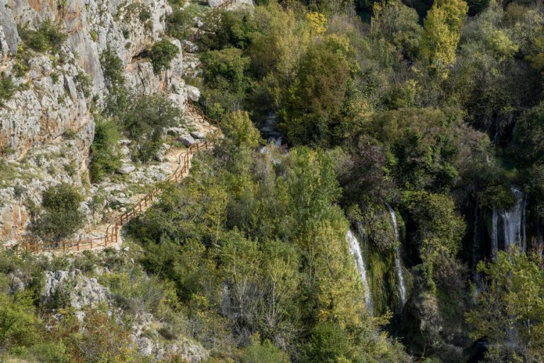
Roman road trail
Pješačka staza Rimski put DUŽINA 630 m VIDIKOVCI: START/END: Ivoševac Na parkiralište se dolazi iz Ivoševaca, iz smjera Kistanje – Knin Staza Rimski put Na
In the very middle of the Krka River, like lace across the chest of a bride from Bogatić, are scattered a row of travertine cascades that the locals call the Necklaces. When the water flows over them in the broad fan-shape of the Roški Slap Cascade, it falls into the lake. Squeezed between the canyons of the Krka and Čikola Rivers, this entire site radiates the rich history of life in this region. Ogrlicama. Kada voda preko njih prijeđe, u širokoj lepezi Roškog slapa, ruši se u jezero. Stiješnjen među kanjonima rijeka Krke i Čikole, cijeli lokalitet odiše bogatom poviješću življenja na ovim prostorima.
Walking along the Roški Slap path, one truly realizes that water is the source of life. Look at the innumerable little waterfalls, and the backwaters as they jump and murmur. The water supplied this canyon with its lush vegetation. The Illyrian-Adriatic endemic Croatian bellflower grows in the cracks of the canyon cliffs. In the river, brown trout and chub swim. The greenery hides the forest brown toad and the large green marsh frog or the terrapin. Rocky ground with bushy vegetation is the habitat of the large green lizard, and the rare mammals include wildcats and otters.
The path leads by bridge over the Necklaces, the most beautiful decoration of this site, to the watermills, a preserved monument of rural architecture and economic history. Given the rich tradition and vernacular expression to which they testify, they are also considered an ethnological-ethnographic monument. The Krka flows here in small streams and gurgles in small falls, so the mills are an ideal place to rest, have a snack, and enjoy the sounds of the river
At the top of the canyon is the Oziđana Cave, which has provided shelter for man since the Late Stone Age. Visitors can pass over a bridge with 22 stone arches crossing the banks of the Krka River that was left to us by the inhabitants from the Roman period. It is thought that the Roški Slap waterfall received its name from the medieval fort of Rogovo on the right bank of the river above the Među gredama canyon, and today a pedestrian path leads to the spot where it once stood, now a lookout point
From the Necklace to the place where the Roški Slap waterfall falls into the lake, the canyon is wide and open. Upstream, it again narrows towards the upper Krka River. This is the spot where the excursions boats dock to take visitors through the narrow Brzica Straits to Carigradska Draga where the Krka Monastery is located.

Pješačka staza Rimski put DUŽINA 630 m VIDIKOVCI: START/END: Ivoševac Na parkiralište se dolazi iz Ivoševaca, iz smjera Kistanje – Knin Staza Rimski put Na
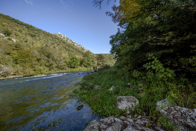
Pješačka staza Perice DUŽINA 1800 m VIDIKOVCI: START/END: Nečven Staza Perice Dolazak od Nečvena, na lijevoj obali, u smjeru Oklaj – Kistanje Automobile je moguće
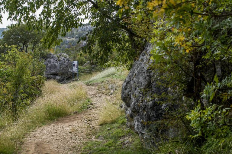
Pješačka staza Manojlovac DUŽINA 360 m VIDIKOVCI: START/END: Ivoševac Na parkiralište se dolazi iz Ivoševaca, iz smjera Kistanje – Knin Staza Manojlovac Na parkiralište se
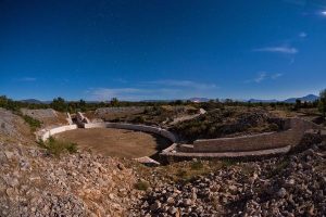
Krka Bike Trek 1 DUŽINA 11,4 km USPON 273 m TEŽINA 1/4 VIDIKOVCI: BURNUM START/END: PULJANE (centar za posjetitelje) N 44° 00’ 06.3” E 16°
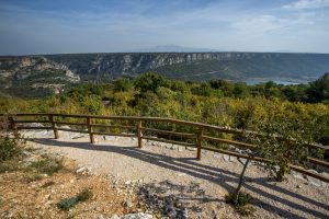
Krka Bike Road 1 DUŽINA 58,8 km USPON 1156 m VIDIKOVCI: KANJON ČIKOLE, ROŠKI SLAP, LAŠKOVICA START/END: SKRADIN (centar za posjetitelje) N 43° 49′ 01,5’’

Krka Bike MTB1 DUŽINA 25,8 km USPON 680 m TEŽINA 2/4 VIDIKOVCI: Žurića brdo, Brdo sv. Kate, Vukovića podi START/END: SKRADIN (centar za posjetitelje) N
Plan your vacation and explore the unknown treasures of the Krka River.
Person in charge of communication: Ivona Cvitan
E-mail: ivona.cvitan@npk.hr
| Cookie | Duration | Description |
|---|---|---|
| cookielawinfo-checbox-analytics | 11 months | This cookie is set by GDPR Cookie Consent plugin. The cookie is used to store the user consent for the cookies in the category "Analytics". |
| cookielawinfo-checbox-functional | 11 months | The cookie is set by GDPR cookie consent to record the user consent for the cookies in the category "Functional". |
| cookielawinfo-checbox-others | 11 months | This cookie is set by GDPR Cookie Consent plugin. The cookie is used to store the user consent for the cookies in the category "Other. |
| cookielawinfo-checkbox-advertisement | 1 year | The cookie is set by GDPR cookie consent to record the user consent for the cookies in the category "Advertisement". |
| cookielawinfo-checkbox-necessary | 11 months | This cookie is set by GDPR Cookie Consent plugin. The cookies is used to store the user consent for the cookies in the category "Necessary". |
| cookielawinfo-checkbox-performance | 11 months | This cookie is set by GDPR Cookie Consent plugin. The cookie is used to store the user consent for the cookies in the category "Performance". |
| elementor | never | This cookie is used by the website's WordPress theme. It allows the website owner to implement or change the website's content in real-time. |
| viewed_cookie_policy | 11 months | The cookie is set by the GDPR Cookie Consent plugin and is used to store whether or not user has consented to the use of cookies. It does not store any personal data. |
| Cookie | Duration | Description |
|---|---|---|
| _ga | 2 years | This cookie is installed by Google Analytics. The cookie is used to calculate visitor, session, campaign data and keep track of site usage for the site's analytics report. The cookies store information anonymously and assign a randomly generated number to identify unique visitors. |
| _ga_JE6JBWK5RM | 2 years | This cookie is installed by Google Analytics. |
| _gat_gtag_UA_204873174_1 | 1 minute | This cookie is set by Google and is used to distinguish users. |
| _gid | 1 day | This cookie is installed by Google Analytics. The cookie is used to store information of how visitors use a website and helps in creating an analytics report of how the website is doing. The data collected including the number visitors, the source where they have come from, and the pages visted in an anonymous form. |
| CONSENT | 16 years 4 months 19 days 3 hours 13 minutes | These cookies are set via embedded youtube-videos. They register anonymous statistical data on for example how many times the video is displayed and what settings are used for playback.No sensitive data is collected unless you log in to your google account, in that case your choices are linked with your account, for example if you click “like” on a video. |
| Cookie | Duration | Description |
|---|---|---|
| IDE | 1 year 24 days | Used by Google DoubleClick and stores information about how the user uses the website and any other advertisement before visiting the website. This is used to present users with ads that are relevant to them according to the user profile. |
| NID | 6 months | This cookie is used to a profile based on user's interest and display personalized ads to the users. |
| test_cookie | 15 minutes | This cookie is set by doubleclick.net. The purpose of the cookie is to determine if the user's browser supports cookies. |
| VISITOR_INFO1_LIVE | 5 months 27 days | This cookie is set by Youtube. Used to track the information of the embedded YouTube videos on a website. |
| YSC | session | This cookies is set by Youtube and is used to track the views of embedded videos. |
| yt-remote-connected-devices | never | These cookies are set via embedded youtube-videos. |
| yt-remote-device-id | never | These cookies are set via embedded youtube-videos. |
| yt.innertube::nextId | never | These cookies are set via embedded youtube-videos. |
| yt.innertube::requests | never | These cookies are set via embedded youtube-videos. |
Entrance tickets can be purchased here.

