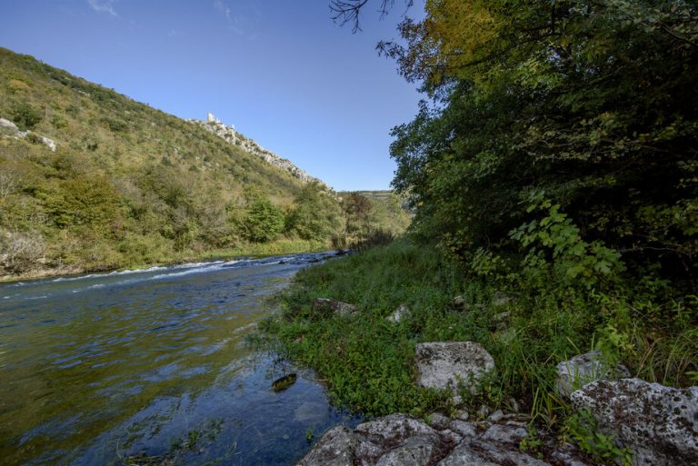
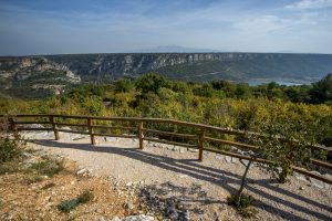
The Krka and Čikola are stubborn rivers. For eons, they have cut through the limestone rock, creating deep canyons with a series of karst forms. This rock is powerful, reminding us of what is essential, like a grey-bearded wizard. Without ornamentation, with just the occasional shrub, we too feel stripped bare and small, as though walking among the stone giants. Ključica appears like a fatamorgana, rock built upon rock, the fortress of the medieval Croatian rulers.
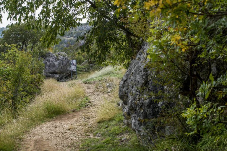
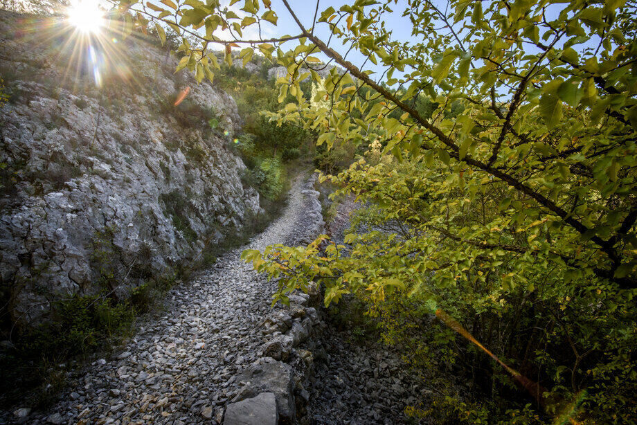
But karst is difficult to tame. It takes a rugged man. For nine years, Gluvo blazed a trail with his own hands over a thousand metres, from his home in Brnjica to the miserly waters of the Čikola. Born in 1926 under the name Marko Ljubić, he lived a long 80 years, leaving us Gluvo's trail, which today is the walking trail from Brnjica to the Čikola River. This hard-working and dedicated man was deaf, which gave him his nickname Gluvo (In Croatian gluh = deaf). Perhaps this is the only place where his handicap was not important, as here nature is always in overwhelming silence. Giving the eye twice the pleasure.
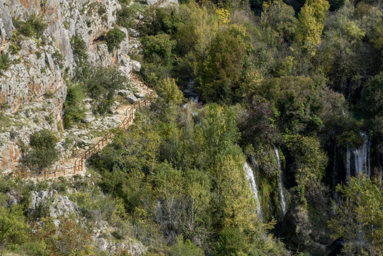
Gluvo's trail descends down to the banks of the Čikola River, the Krka's largest tributary. In the summer months, it runs dry, but even then, the images of the large and small light-coloured, rocks, rounded by the water is impressive. The Čikola is a two-sided river. Up until Drniš it runs like a lowland river, through the karst fields, giving it the local name Poljšćica, meaning “river that runs through the fields”. After Drniš, the canyon part of the course begins, which gave its present-day name: the word čikola or čikojla originated from the Turkish, meaning “water through cliffs”.
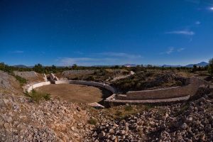
The Čikola Canyon is marked by its wildness, emphasizing the impressive forms of the rapids, the permeability of the canyon and the often dry riverbed. This inaccessibility was desirable in the past, and here we find two caves containing Palaeolithic finds, and the Ključica fortress, the largest and best preserved medieval fortress in Krka National Park. The Čikola River Canyon is 14 km in length, and up to 170 deep in some places. It begins immediately after the river leaves Petrovo Polje field, near Drniš, and ends 6 km before it drains into the Krka River, or just 3 km before the submerged, lake-like section of the river begins.
Kanjon Čikole odlikuje izrazita surovost, koju naglašuju impozantni oblici brina, neprohodnost kanjona i često presušivanje riječnog korita. Takva nepristupačnost bila je poželjna u prošlosti, tako da na tom području nalazimo dvije pećine s paleolitskim nalazištima i utvrdu Ključicu, najveću i najočuvaniju srednjovjekovnu utvrdu na prostoru Nacionalnog parka „Krka“. Kanjon rijeke Čikole dug je 14 km a dubok mjestimično do 170 m. Počinje odmah na izlasku rijeke iz Petrova polja, kod Drniša, a završava 6 km prije njezina ušća u Krku, odnosno 3 km od ujezerenog dijela rijeke.
