

VIEWPOINTS
Krnići Gornji viewpoint
Capture the exceptional (summer) lushness of the Krka with a view from the viewpoint: confluence of the Krka and Čikola Rivers
If your travels bring you this way, to Krka National Park or another destination, or if you are just passing by while on your business, remember to stop and take in a view of the Krka River. All you need to do is turn off the main road and following the brown tourist signs to reached a viewpoint that offers a spectacular view over the vast blueness and greenness of Krka National Park.
One such sight is the confluence of the Krka and Čikola Rivers. If you do not turn towards Lozovac, but instead from the direction of Šibenik continue on towards Pakovo Selo. On the left-hand side of the road, in Krnići Gornji, you will find a lovely viewpoint that offers the most spectacular view of the confluence.
The raising of the travertine barrier at Skradinski buk led to the formation of a lake-like section for 13 kilometres upstream of the barrier, which also submerged the course of the Čikola River, creating Croatia's most unusual confluence landscape. The island of Kalički Busen in the middle of the confluence makes it even more special, as a 700 metre long and just 10 metre wide travertine barrier that separates the Krka from the mouth of the Čikola. The excursion boats taking visitors to the upstream lake-like sections and Visovac Island also sail past this island.
Čikola, the main tributary of the Krka River, runs through the broad Petrovo Polje field before pressing into the narrow, 14 kilometre long canyon. Once it leaves the canyon, it drains into the Krka in the lake-like confluence, where the rivers come together to create a truly impressive vista. You can enjoy this unusual panorama if you turn into the hamlet of Krnići Gornji, where you can also find refuge from the summer heat, find some refreshment and enjoy the fragrances of the gardens at one of the many rural estates.
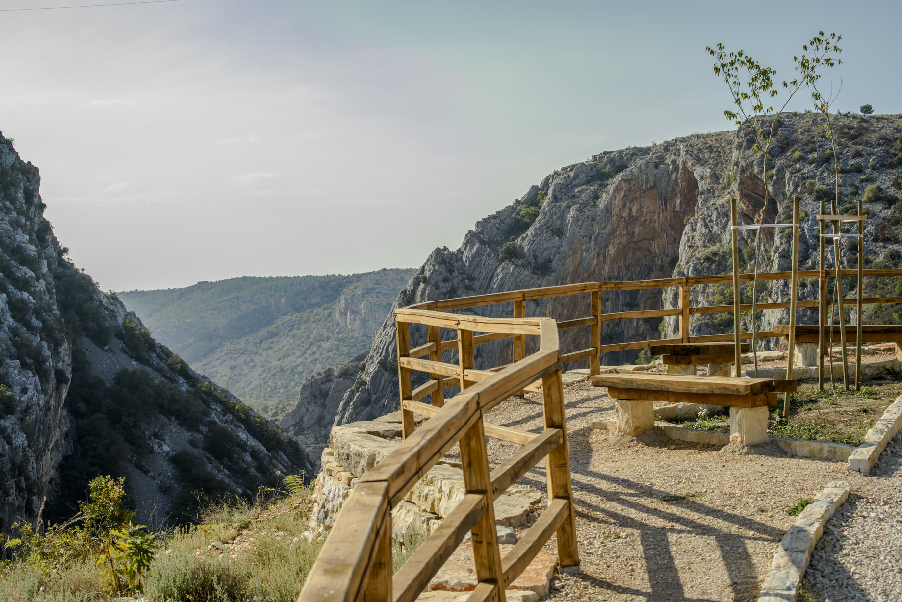
Čikola viewpoint
Catch a view of the distinctive (summer) grandeur of the Krka River from a lookout point: the Čikola canyon
If you travel on the left bank of the Krka River towards Visovac or the Roški slap waterfall, before you reach the Miljevci plateu, an unusual stony flat area, home to some of the greatest natural, cultural and historal beauties of Croatia, you have to go through the canyon of the Čikola River.
While you are driving along serpentine turns, the view will draw you to the high cliffs of the canyon, so why not stop and look at them a bit more? On the right bank of Čikola, right next to the road from Šibenik towards Pakovo Selo, there is a rest area and viewpoint overlooking the distinctive karst river fighting against drought hemmed in by limestone cliffs.
The canyon of the Čikola is characterized by a pronounced roughness, emphasized by the imposing forms of juniper, the impassability of the canyon, and the frequent drying up of the river bed. Such inaccessibility was desirable in the past, so this area contains two caves with Paleolithic sites and the fortress of Ključica, the largest and best preserved medieval castle in the Krka National Park. The canyon of the Čikola River is 14 km long and in places up to 170 m deep. It begins immediately at the exit of the river from Petrovo plain, near Drniš, and ends 6 km before its discharge into the Krka, or 3 km from the lake-like part of the river. It has been a protected area since 1965.
The gently sloping sides of the canyon are overgrown with dense undergrowth and groves of oak, hornbeam, and other trees. Along the water, one can see cormorants and many other birds with aquatic habitats. In the dry period, the impressive image is made by the pale rocks in the riverbed that were smoothed by the river.
Visovac viewpoint
Catch a view of the distinctive (summer) grandeur of the Krka River from a lookout point: Visovac
Visovac Island, surrounded by its recognizable landscape of poplars, and resting on the quiet, lake-like part of the river, is a site that one can enjoy from several places on the banks of the Krka River, but there is only one official lookout point. On it, his gaze focused on this “Island of Our Lady”, stands Petar Svačić, the last Croatian national king, holding a sword in one hand and in the other a shield.
According to legend, Petar Svačić, the last king of Croatian blood, was born in the castle of Kamičak, raised above the cliffs of the Krka canyon, in the Miljevci plateau, by the edge of the village of Brištane. In 2002, on the occasion of the celebration of the 900th anniversary of his death, a monument to him was erected at the top of the Visovac cliff, the work of the academy trained sculptor Kažimir Hraste.
From this viewpoint, a serpentine road descends to Stinice, the dock for the ships that transport travellers and pilgrims to Visovac. This is where the mystic middle course of the Krka River begins. This impression is first heralded by “Our Lady of Visovac”, the "white rock" in the middle of the lake, where Franciscans have lived and prayed since the 15th century.
That's why this lookout point is ideal to stop for a little and admire the open nature of the setting before you head to the island itself or stroll through the centuries-old woods of downy oak and oriental hornbeam, where the pedestrian-footpath of Stinice – Roški slap – Oziđana pećina cave begins and where the Kuželj House Visitor Center is located.
Brljan viewpoint
Catch a view of the distinctive (summer) grandeur of the Krka River from a lookout point: Brljan
When you cross the Krka River at the crossroads that were part of the network of Roman roads between Bukovica and Promina in the Roman period, the magnificent view from the top of the serpentine road on the righthand, Bukovica side will force you to stop. There is a small resting area and a decorated lookout point overlooking Brljan. It is believed that Emperor Trajan went along this route during the invasion of Dacia. For located behind Brljan, is Burnum, a Roman military camp and settlement, which the local people have long called “Trajan’s City”.
The whole area exudes a tumultuous past, a time in which the river divided tribes and peoples, and opponents were monitored from today's vantage points. Even today, from this place in Puljane, on the left bank of the Krka River, the remains can be seen of a prehistoric hillfort, the center of the Liburnian community of Burnistae.
From this lookout point, you can see lush sub-Mediterranean vegetation, which hides the former water mills, small pastures, and cultivated fields. This is where the Krka Rivers becomes more tame. The Brljan waterfall itself is dry in the warm part of the year. It is followed by a 1.3 km lake formed by the construction of a dam. Brljansko Lake (Ćorića Lake, Bjelober) is 400 m wide and 1300 m long. A powerful impression is made on visitors by the breadth of the open space under the lookout point and the sense of freedom that such a view evokes. If you find yourself there, say, on August 13th, it would be a great opportunity to visit the Burnum amphitheatre and enjoy the re-enacted life of the ancient Romans through the rich Burnum Ides program.


